CCAMLR Science Toolbox
www.ccamlr.org
Seabed area estimation – an example in Subarea 48.6
Estimating planimetric seabed area (i.e., the area between two isobaths) is a common task in CCAMLR works (e.g., in the Trend Analysis). The R script linked below provides an example in which seabed area is estimated for the entire Subarea 48.6 and its Research Blocks (Fig. 1).
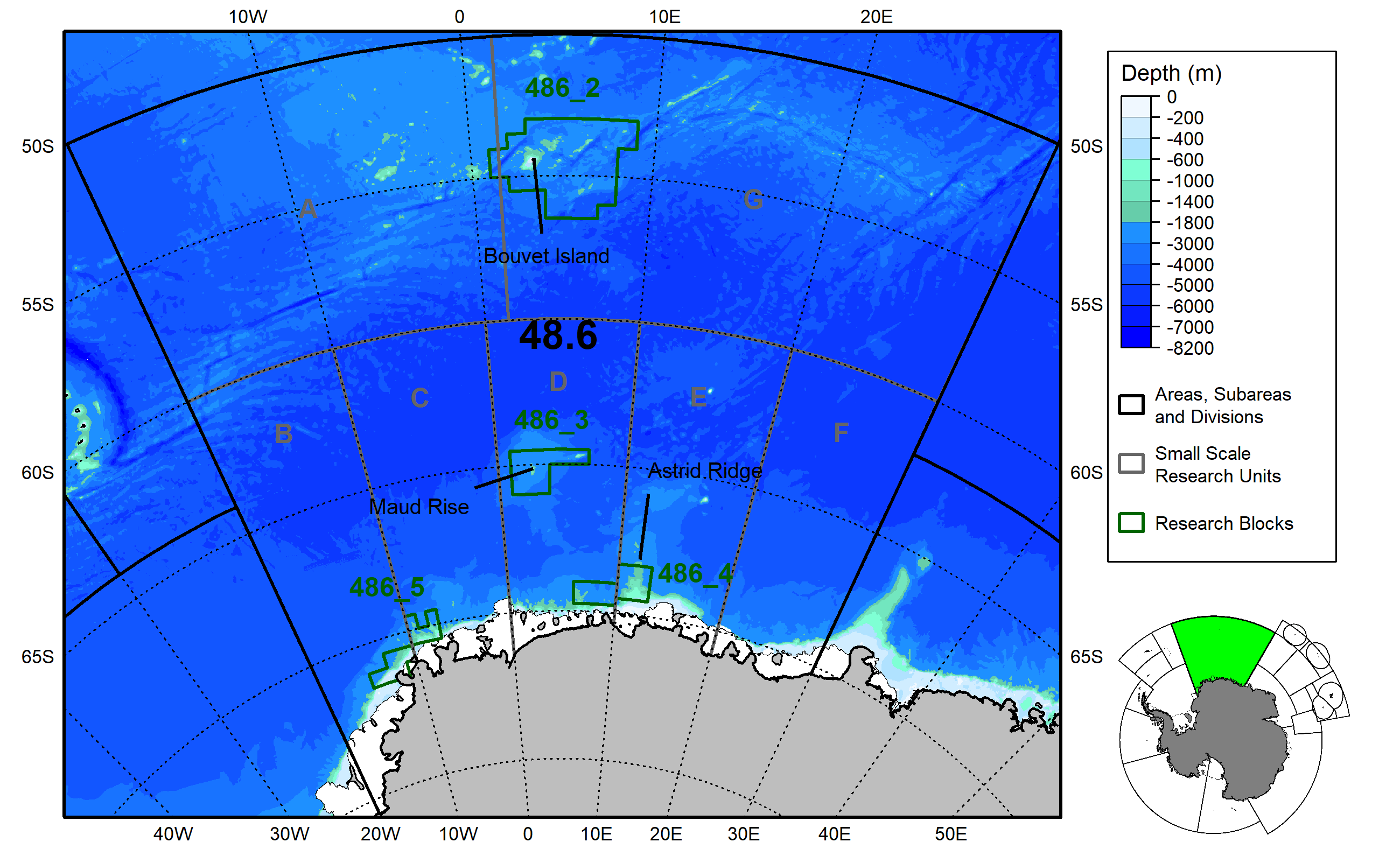
Figure 1. Map of Subarea 48.6 and its Research Blocks (Source). The “fishable area” (seabed area between 600 and 1800m) is shaded in green.
Steps
-
Create a folder, a new R project in that folder, and put the R script in that folder,
-
Download the un-projected bathymetry from here (link to come) and put it in that folder,
-
Open the R project and run the script. A csv file will be created in your folder (Table 1).
Table 1. Seabed area (km$^2$) between 600 and 1800m (referred to as “Fishable area”) in Subarea 48.6 and its Research Blocks.
| GAR_Long_Label | Fishable_area |
|---|---|
| 48.6 | 80964.82 |
| 48.6_2 | 9330.55 |
| 48.6_3 | 943.37 |
| 48.6_4 | 10511.03 |
| 48.6_5 | 8390.91 |